Ujung Kulon National Park
42264 Pandeglang, Indonesia
Ujung Kulon National Park Biodata Perusahaan
Informasi umum
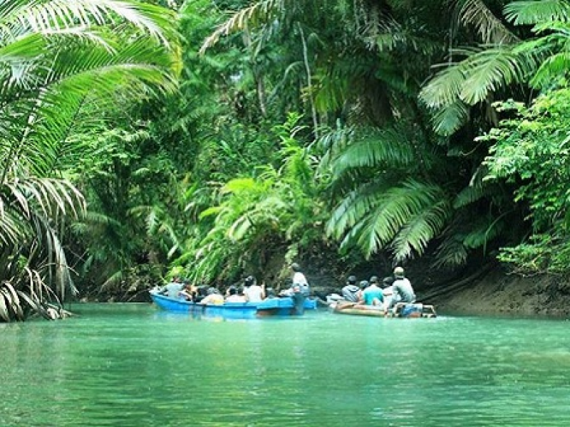
Ujung Kulon National Park or Taman Nasional Ujungkulon is located in the southwest of Java, and is part of the district of Pandeglang. To the east of the National Park of Gunung Honje ridge runs north-south, which rises up to 620 m. At the southern end joins a peninsula to the west. This peninsula, which are upstream to the north as Handeuleum other islands, as well as Peucang Panaitan. The land area covers 76 214 hectares, the adjacent sea zone further 44 337 hectares. The peninsula of Ujung Kulon is mostly flat, with the exception of Gunung Payung with 480 meters to the southwest. Panaitan has the Gunung Raksa a central elevation of 360 meters. The group around the island Krakatoa is located approximately 60 km north of Ujung Kulon National Park in the Sunda Strait between Java and Sumatra and covers 2,500 hectares. To the west of Gunung Honje is followed by a narrow strip of land bordering before wide sandy beaches along the Sunda Strait. The north east coast of the peninsula is mostly marshy. In the north and west of alternate narrow sandy beaches and reefs. In the southwest, the hills fall steeply down to the sea. The south is dominated by wide sandy beaches.
Penawaran perusahaan
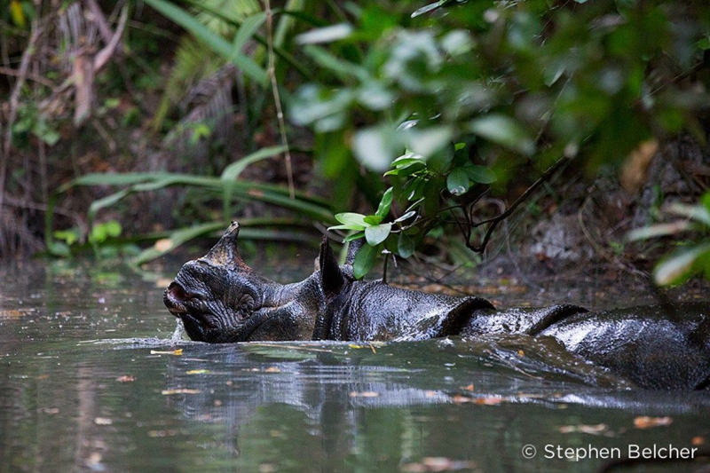
javan rhino tour
Jl. Perintis Kemerdekaan No.51 Labuan Pandeglang
- Jam buka
-
Senin:09:00 - 16:00Selasa:9:00 - 16:00Rabu:09:00 - 16:00Kamis:9:00 - 16:00Jumat:9:00 - 16:00Sabtu:9:00 - 16:00
- Nomor telepon
- Situs web
- Tahun pendirian
- 1992
- Formulir kegiatan
- Bentuk hukum
- Unit organisasi negara
- Kategori
- taman
Foto
Ujung Kulon National Park Ulasan & Peringkat
Bagaimana Anda menilai perusahaan ini?
Apakah Anda pemilik perusahaan ini? Jika ya, jangan lewatkan kesempatan untuk memperbarui profil perusahaan Anda, menambahkan produk, penawaran, dan posisi yang lebih tinggi di mesin pencari.